Step 1 – Read this blog post 🙂
Jabal Jais is the highest mountain in the UAE, reaching almost 1,900m above sea level (6,000 feet), however the highest point of the mountain range is actually located just on the other side of the border in Oman – it reaches 1,911m above sea level.
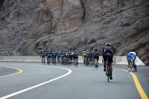
It’s a hugely popular cycle route up the mountain
Step 2 – gather a group of friends and head out to Ras al Khaimah

Friends of mine are going to be hiking up Mt. Blanc in July and so they need to get some hiking practice in and the best place to do that is obviously the highest mountain in the UAE, which is thankfully only a 2-hour drive from home.
Pretty much the only bit of information that we had with us was the location of the starting point, so that’s where we met, loaded up with bags full of water, food, energy gels, cameras and a load of excitement for the day ahead. Let the adventure begin!


The hike is fairly self-explanatory and completely do-able without a guide, however, having some proper information on where you’re going is a MUST! And having some tips and pointers about the hike will absolutely make your entire experience a lot more enjoyable… so, after we learned the hard way that you need to have some of this information beforehand, I decided that I would put together a how-to guide on getting to the top and back down, with as little getting lost as possible 🙂

The mountain range up ahead!
Here is what we learned on the day:
- The hike itself is a round trip journey – not an up-and-back-down route
- This is NOT a simple hike, and it is a lot tougher than you expect
- Wearing the appropriate shoes is a MUST

What NOT to wear!
- There is a lot of climbing over big boulders and rocks – this is not just a walk along a path up through the mountains
- There are red dots and arrows painted on rocks in the valley / wadi – USE them to guide you
- There are rock formations laid out along the way – they can be difficult to find since you’re already surrounded by rocks, but use them! When you’re feeling completely lost and then see a rock formation, it is the best feeling in the world (we had this a few times 😉 )
- Walking along the wadi bed, you will reach an area where the valley starts narrowing and you see palm trees in the distance – a little oasis type of area… this is a great spot for lunch as it is shaded and has a great flat area to sit down and rest
- Keep left of this oasis area when you continue on – from here it gets a little confusing and there are no longer red dots or rock formations to help you
- You need to climb up through the rocky bits, you will reach what seems to be the top and come to an open area – this is not the top! You need to continue walking towards the peak that you see in front of you, and over the edge of that
- Once you’ve reached the edge of that final peak, you will see a village down below – head towards the village, and if you’re lucky, the friendly farmer there will probably offer you tea
- From here you have 2 options to get down – the short, very dangerous route, or the longer, slightly easier and less dangerous route… the farmer will help guide you / point out the routes
- You’ll get back down the mountain and into the wadi, and eventually reach the road – here you want to turn left and this will bring you right back to the car park 🙂
And here’s our story 🙂
We set off at about 8:30am, walking in what we thought was the right direction… but about 20 minutes into the walk we started feeling unsure of ourselves. We had seen a group of (what looked like) climbers back at the start so we made the decision to head back to them and ask for some help… another 20 minutes back.
They were extremely helpful, even managing to give us a printed map which showed us that the hike is a round trip, and they gave us a few pointers and some basic directions – starting with getting back to where we had just come from 😦 So, by the time we actually started on the hike we had wasted almost an hour.


The next hour and a half or so was thoroughly enjoyable, climbing over rocks, looking for the red dots and getting well excited when we found one, and eventually figuring out for ourselves that the rock formations were also a guide on which way to go.


These climbers had told us to look out for the palm trees and keep left of them when we head up the hill, and since we felt as though we’d made it to there in a reasonable amount of time, we decided to sit here for lunch and take a bit of a break, and share the experience with the local friendly mountain goat who decided to join us.


From here we had been told that we need to walk over the top of the mountain, and on the other side we’d see a village… so we thought we were not that far off. How wrong we were! We reached what we thought to be the top, and as we rounded the other side we realised that we were still a long way off from the top, and we could not find any dots or rock formations to show us exactly which way to go. It’s a large open area with many different directions to be able to go in and it took us a long time to find our way. But we kept walking and walking and walking and eventually we rounded a bit of a corner and I screamed out “I SEE A VILLAGE!” Boy was that an exciting moment in our lives 🙂


We made it down to the village and the friendly farmer came out and offered us some tea. We declined, but asked him for some directional help. He told us about the 2 different options on getting down and then spent some time pointing the 2 options out to us… and after we opted for the longer, less dangerous route, he guided us down part of the way until he eventually left us to our devices and headed back to his village.
The last bits of the walk down are pretty intense with a lot of loose rocks / stones to navigate through, and when you eventually reach the bottom of the mountain, you then have to go back to lots of boulder climbing as you find your way out of the wadi.

Some easy parts of the wadi
We eventually reached the end and practically jumped for joy when we saw the road and cars ahead of us… but now had another choice on which way to go. Do we go left or right? We eventually decided on left and when we saw the car park area loom up ahead of us, I almost broke into a run – I was so happy to see the end!
Overall it took us 7.5 hours – we definitely would have done it in less time if we’d had a better idea of where to go, which is why I had to write up these pointers for the next person. We had tried googling but found very little information, and any google maps directions that we found wanted to take us up along the road which obviously you don’t want.

All in all it was a great day out and I would definitely do this again – now knowing a bit more about the day 😉


Pingback: 74 Best Mountains To Climb In Asia For Beginners (50 Countries)
Hi there, could you please tell me, what was the starting point of your hike? Was it Wadi Ghalilah Dam? And regarding the map, does it have the name of the publishing house or any similar hint on it, so I can try to get it somehow? Thanks 😉
LikeLike
Hi! Sorry, but I don’t know what the starting point was called. If I recall correctly, we sort of just drove off the road and parked on a sand bit then walked kind of a bit to our left. And the map that we were given was just something that some people happened to have a spare of. It wasn’t any type of official route map. We weren’t exactly ‘well-organised’ on this hike lol!
LikeLike
🙂 OK, no worries. Thanks for the reply anyway
LikeLike
Hi. Great description – thanks! Did you record where you went using a GPS watch or phone?
LikeLike
YES! In fact I did have my phone with me and it recorded our route… great thinking! If there’s a way that I can share it with you (although I doubt you’d get signal up there to use it much) then let me know and I’ll do what I can to help out!
LikeLike
Ok great. Did you upload it to a site such as Strava? Or any other fitness site? If so I can search for it if you give me your username. Or else can you download it and send it to me as a gpx by email maybe? Thanks in advance for your assistance
LikeLike
I use endomondo… and I’m completely useless at technology. My username is Double H. I haven’t a clue how to download it… but you’re welcome to search for it – I’m sure my profile is public. The hike was done on 27 Jan 2017.
Let me know if there’s anything else from my side that I need to do!
LikeLike
Excellent! Found you! Found the route! Downloaded your gpx! Uploaded it my gps unit! Don’t you just live the internet sometimes. Thank you.
LikeLike
WOW!! That’s awesome! Good luck on the hike 🙂
LikeLike
Hi there,
Great article!
Would you be able to share with us a copy of the map you used? A couple of friends and I are keen to climb Jebel Jais in a couple of weeks but as you point out, there is limited information for a good hiking route to the top. Also, is the summit obvious to locate? I understand you can drive most of the way to the top so assume many people make the summit.
Any help would be greatly appreciated.
LikeLike
Hi there! Unfortunately I cannot help with a map; we luckily found some other people hanging around who had one and they gave it to us.
With regards to driving, yes you can drive all the way to the top, but that’s different to hiking it. Driving is on an actual road, whereas hiking is completely off the road. And no, the summit is rather confusing to locate while you’re hiking up… the best piece of advice I can give you to locate the summit is to just keep walking over the hills until you see a small house in the distance – once you’ve found that, you’re ready to start heading down. There’s a super friendly farmer who lives in the house and he’ll help guide you down.
LikeLike
Hi there,
Great article!
Could you share with us a copy of the map that you used? A few friends and I are keen to climb Jebel Jais in a couple of weeks time but there seems to be limited information for a decent hiking route to the top. If you could advise or help us at all that would be great.
LikeLike
Good pointers on the trek. Very well written and information is helpful. Keep adding new experiences.
Trek safe 🙂
LikeLike